As a geographer I just love maps. I can’t help it, I’m obsessed with maps. I like pouring over them and following rivers with my finger tip. I like looking at the coastlines, settlements and physical features. I’m particularly fond of contour lines. I like the colours, used by map makers, especially on older maps.
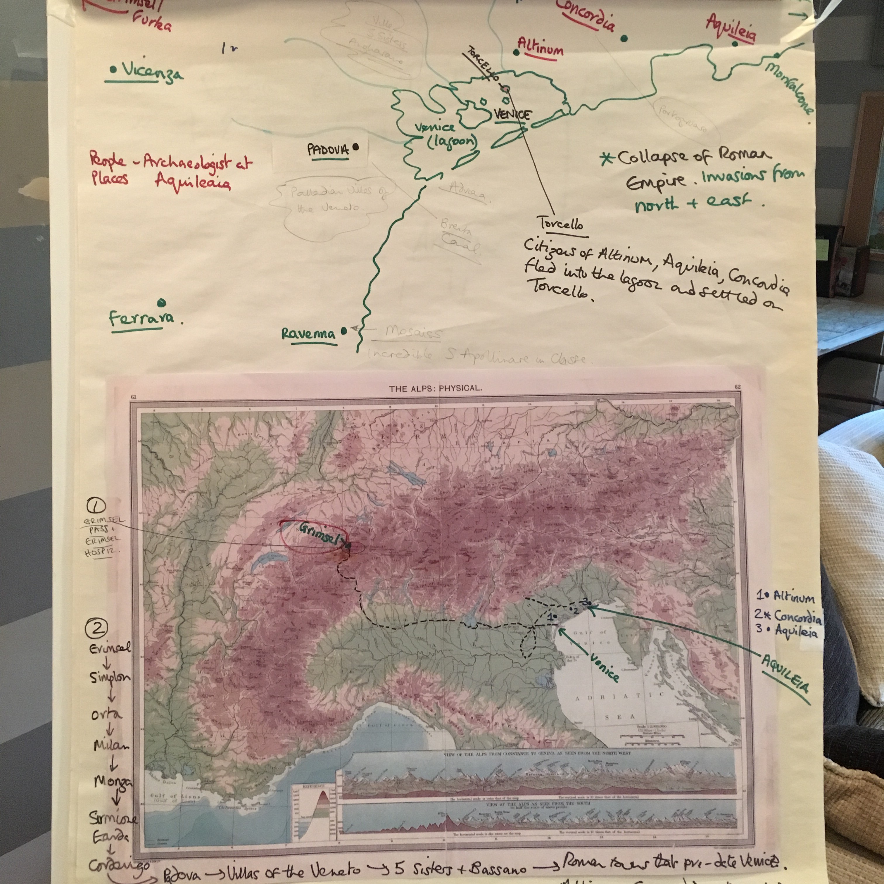
Here’s a copy of my favourite relief map of Northern Italy – published in 1905. I’ve taken a copy of it and stuck it to a large sheet of paper so that I can make notes above, below and around the map. This is a planning exercise for a trip that I ran for a small group of clients in October 2016. I then ran a similar trip in April 2017 – and have run similar trips most years ever since. It’s part of my planning process.
This is the magnificent original of the 1905 map. It shows so clearly the mountains, in shades of brown and beige, depending on their altitude. Then the plains in green. The Adriatic Sea is a relatively shallow sea, coloured in very pale blue. In fact over time (thousands of years) it will eventually silt up. Whilst the Mediterranean to the west is very deep. The Med is, in fact a tectonic basin and thousands of fathoms deep at its deepest point. So the colouring here is a rich turquoise blue.

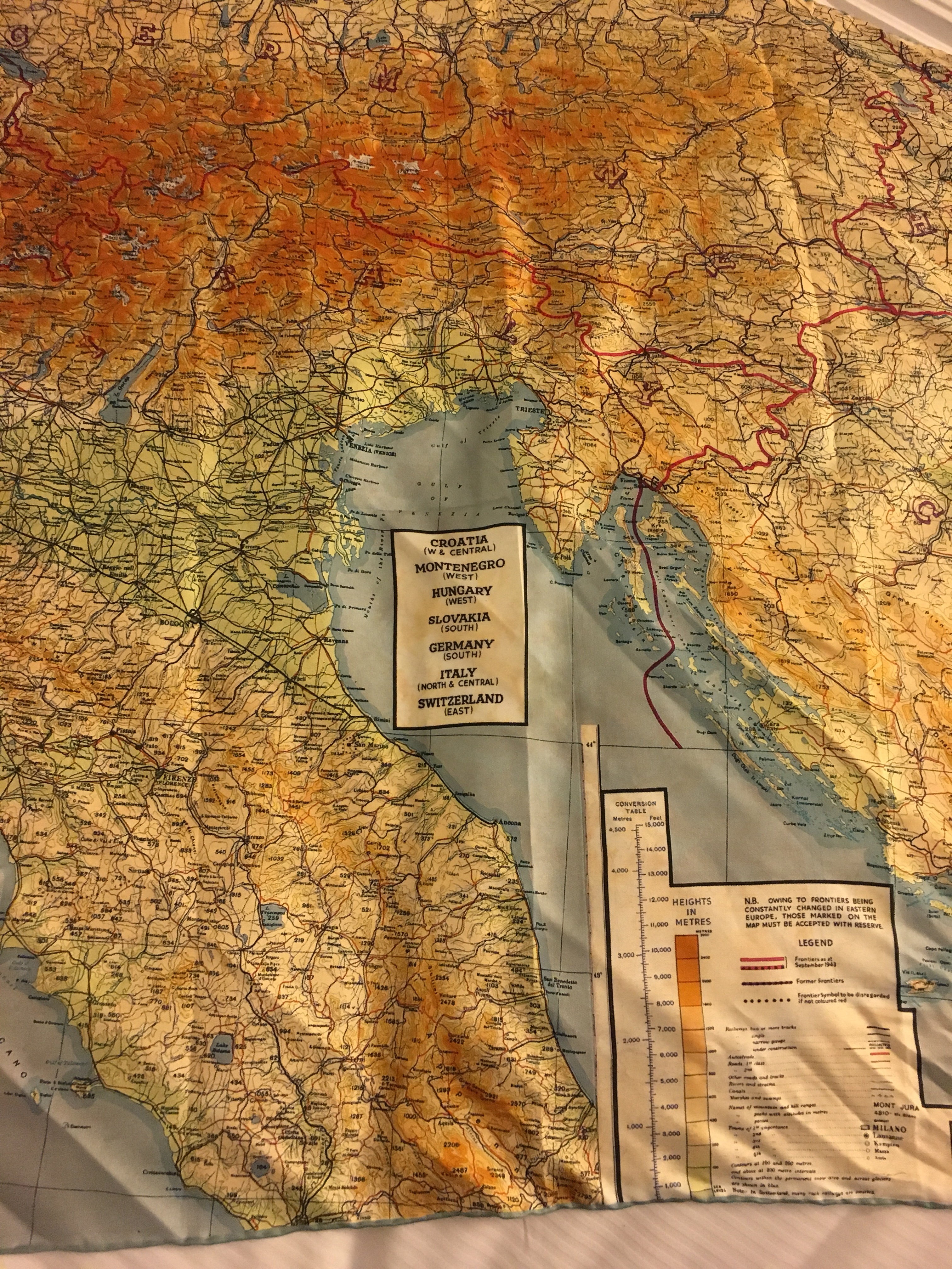
I particularly like the cross sections of the mountains at the bottom of the map. Showing the viewer a side view of the Alpine mountain chain, and the height of the relative peaks. In older maps, the amount of information that could be gleaned from a single page or sheet is quite exceptional. Below is a relief map of north-eastern Italy, running from Venice across the Venetian Plains to Trieste in the east. The mountains fringe the plains to the north, whilst the Adriatic Sea laps the shoreline to the south. The mountainous Istrian Peninsula plunges precipitously into the sea to the south of Trieste.
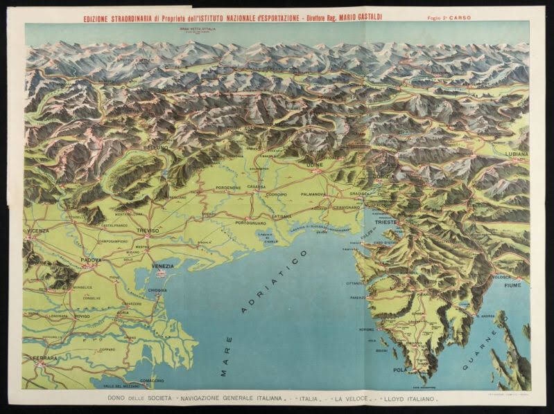
Wonderful relief map of Venice and Veneto region including Istria and Dolomites. c. 1930s. Printed by Lloyd Italiano – photo: www.educated-traveller.com

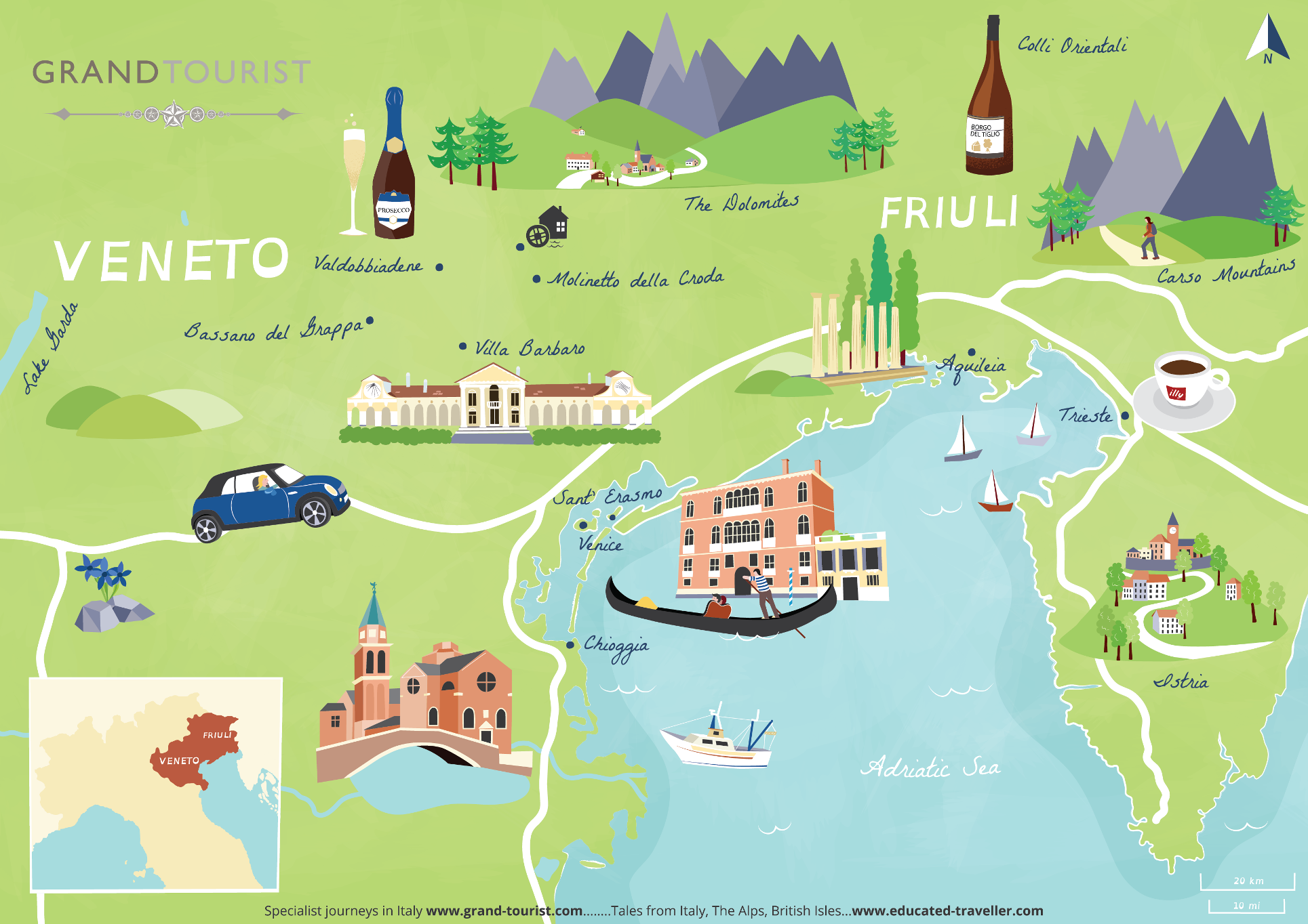
Here’s another map of the north-east of Italy. The region now known as The Veneto. The city of Venezia is the main tourist attraction. Although Padova (university city), Verona (commercial centre) and Vicenza (an architectural city and birthplace of Andrea Palladio) are also important urban centres. Again this map shows clearly the flat areas of farmland and flood plains – coloured in green. Whilst hills and upland areas are shown in various shades of yellow and grey.
I recently commissioned a map from Bek Cruddace of Sicily – here’s the rather wonderful final article:
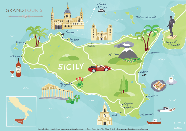

Map from the collection of www.educated-traveller.com

Exceptional relief map of Jerusalem (1928). Part of the Hebrew University Geography Dept Collection.
This is a fantastic topographical map of the city of Jerusalem. It shows the hills that surround the city. It also shows the ancient walls of the city, rebuilt on numerous occasions. The Dome of the Rock, the holiest place in Jerusalem can be seen in the lower part of the map (centre). This map dates from 1928. The art work was by Fr. and R. Stegmiller. It was then printed by Kosel and Pustet in Munich. The map is now in the collection of the Hebrew University, Department of Geography, Jerusalem.
You can learn so much from maps. I’ll be expanding my collection as time allows. Please look and enjoy the small number of maps I’ve posted so far!
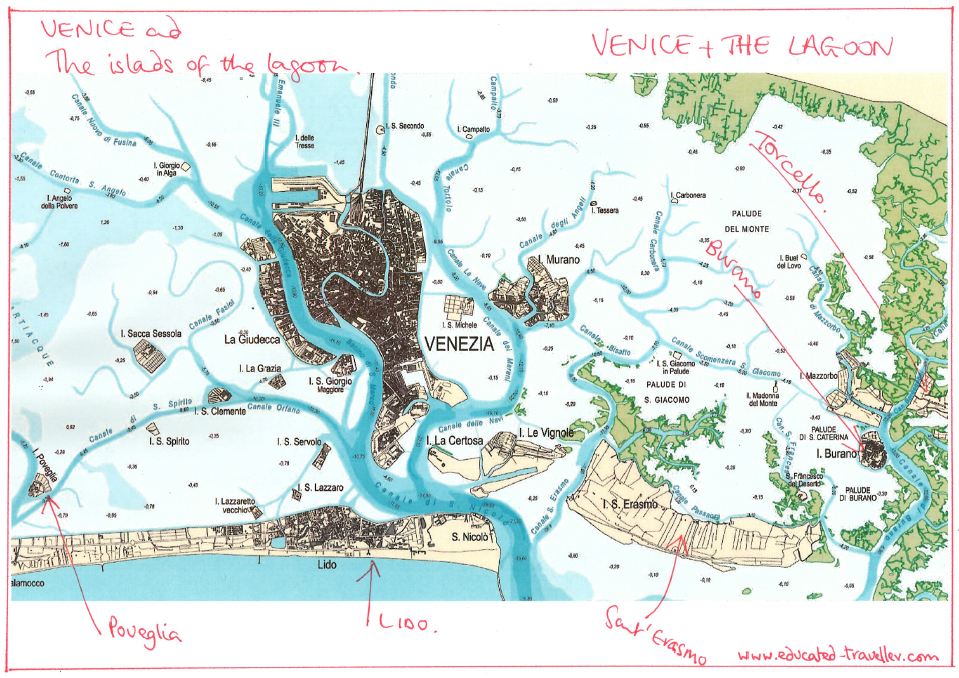
This is a map from the 1930s showing the lagoon of Venice and many of the islands of the lagoon. The navigable channels are shown in dark blue. The islands of Torcello and Burano are surrounded by mud flats and salt marshes. This is an ideal habitat for birds, ducks and geese. This was a favourite hunting location for Ernest Hemingway in the 1930s and 1940s. The island of Torcello was one of the first islands in the lagoon to be permanently inhabited. There is a wonderful cathedral to visit here. On the back wall of the church is a very powerful mosaic depiction of the ‘Last Judgement’ complete with snakes, skeletons and numerous tortured souls, forever condemned to burning flames. You can visit the islands from St Mark’s by vaporetto. Or ‘push the boat out’ and charter your own private boat on the lagoon for the day. A real VIP experience.
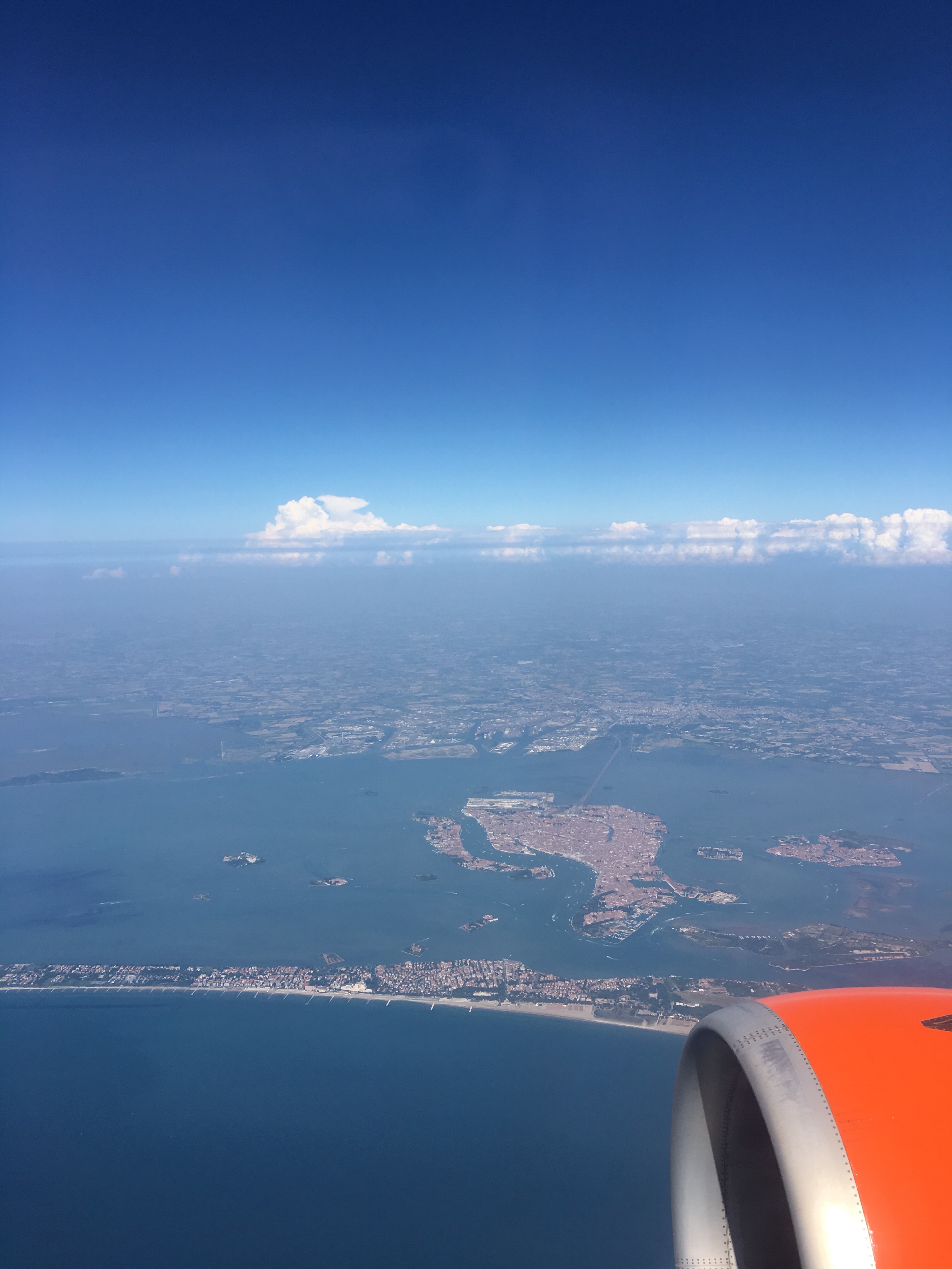
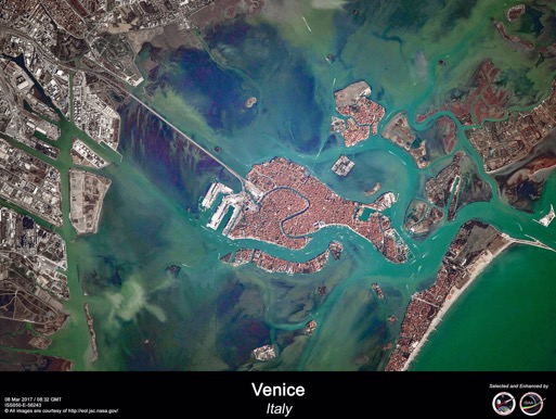
Aerial photo of Venice and the lagoon (2022) – photo: www.educated-traveller.com
It’s interesting to compare the 1930s map of Venice with this photo that I took last year. The lagoon of Venice fills the frame. The city of Venice is centre stage. You can see the Lido of Venice, in the foreground protecting the lagoon from the Adriatic Sea. The Lido is the beach resort of Venice, it is fringed by a sandy beach lined with hotels.
Let’s compare that with a picture taken from the International Space Station, from space, looking down on Venice just about a year ago.
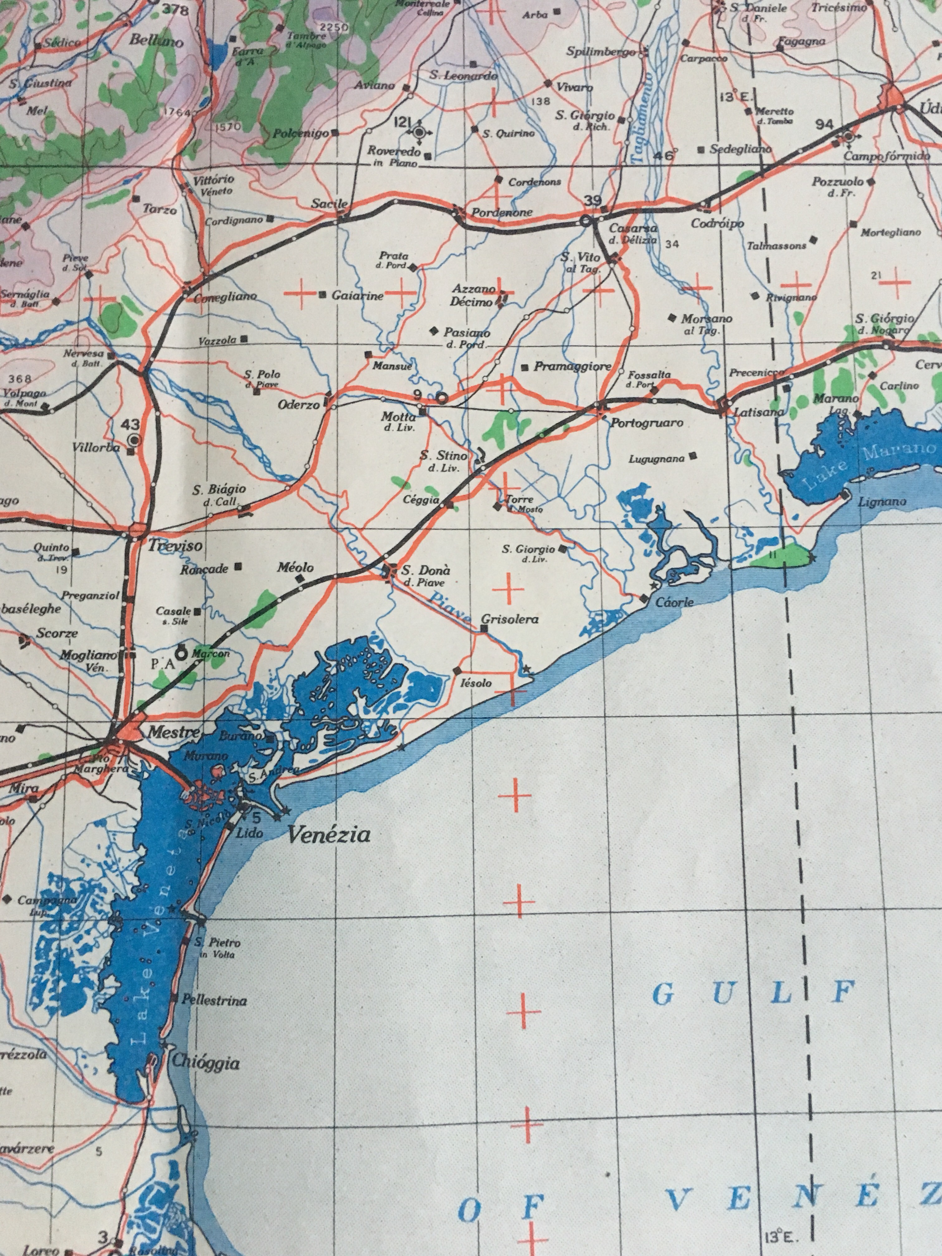
This is a copy of a World War II map known as an ‘Escape Scarf’ www.educated-traveller.com
This is a copy of a World War II map that was given to Allied Forces (British, American, Canadian, Australian) military personnel dropped behind enemy lines during the Second World War – in the 1940s. This silk scarf was durable, useful and printed with a map it could help orientate a soldier parachuted into unknown territory – ideal for finding your way out! The Silk Escape Scarf is a fantastic and true story – you can read more here: The silk escape scarf…
Or what about this beauty from the archives – a 1940s map of the lagoon of Venice and surrounding areas:
- Enquiries and comments welcome!
- For more on the lagoon of Venice – which fascinates me check out an article I wrote last year: Venice and the Lagoon, Italy
- I’ve also written a short piece about Ernest Hemingway here: Ernest Hemingway, Venetian Lagoon
- The title map at the head of the page was designed and created by Fortuny.
- Fortuny are a superb fabric, textile and lighting company based in Venice and New York. I recently wrote about their founder Mariano Fortuny and his fame as a designer. Venice, Silk dresses and Downton Abbey
- Investigate this blog www.educated-traveller.com for so many interesting articles!
- Happy Reading!
- Updated many times: 2018 / 2019 / 2020 / 2022 / 2024

July 2025

